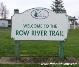
The Row River Trail is an amazing asset to our community. It has been fun to explore it in depth here on the blog over the past year. For people who don’t live in the immediate area or who don’t have the time to explore the full 15.5 miles of the trail, you might be wondering what parts of the trail are the most interesting and most worth your time. Where do you start?
Below I have outlined the major trailheads along the Row River Trail. At each of these trailheads you will find ample, free parking and (usually) vault toilets and garbage cans. Hopefully this guide will help you plan your visit to the Row River Trail.
Before we begin I would like to note that there are several places where the trail crosses major rural roads and people have died at these intersections. Please use caution; while there is not a lot of traffic on these roads, the traffic that is there is going fast (usually over 55 mph) and drivers don’t always have the best visibility of the trail.
Trailhead Park
Located in downtown Cottage Grove, Trailhead Park is the beginning of the Row River Trail. From here, the trail heads east. The first mile or so will take you through the heart of town and then the trail follows Mosby Creek Road with pastoral and mountain views.
Getting There:Trailhead Park is located in downtown Cottage Grove at the intersection of E. Main Street and S. 10th Street. It is probably best to park at Bohemia Park (on 10th Street) and walk across Main Street to reach Trailhead Park.
Mosby Creek Trailhead
Starting at trial mile “3”, Mosby Creek Trailhead is the most developed trailhead along the Row River Trail — the parking lot is paved, and there are toilets and drinking fountains.
Heading east from this trailhead, for the next 1½ miles prepare to enjoy several of our local bridges, including the Mosby Creek and Currin Covered Bridges and two steel railroad bridges (the first one, just east of the parking lot, is famous for its appearance in the movie “Stand By Me”). If you would like a closer view of the Currin Covered Bridge, take the gravel road from the Row River steel railroad bridge to Layng Creek Road for a closer look.
Getting There: From Trailhead Park (and downtown Cottage Grove) head east on Main Street, it will eventually turn into Mosby Creek Road. 2.5 miles from downtown, turn left onto Layng Creek Road then left again into the trailhead parking lot.
Dorena Dam Trailhead
Dorena Dam Trailhead is an excellent starting point for anyone wanting to focus their experience on Dorena Reservoir. Starting at trail mile “6.5” and heading east for the next four miles you will experience many views of Dorena Reservoir with occasional picnic tables and benches provided.
Getting There: From Mosby Creek Trailhead continue on Layng Road for 1.4 miles, turn right when it ends at Row River Road. In 1.2 miles turn left to stay on Row River Road. Dorena Dam Trailhead is on your right 1.2 miles past the turn.
Harms Park
At trail mile “8.5,” this trailhead includes a boat ramp, picnic tables, and a vault toilet. Local historians might consider looking down into the lake from the boat ramp. This is where the original town of Dorena was located before it was moved to accommodate the reservoir and the 100 feet of water that would cover it. It is not uncommon to see bald eagles or osprey around Harms Park or further east along the trail.
Getting There: Continue past Dorena Dam Trailhead for 1.8 miles (3.0 miles after the turn) to reach Harms Park.
Bake Stewart Park
At trail mile “11,” Bake Stewart Park is the newest trailhead for the Row River Trail. Bake Stewart Park is one of the few remaining oak prairie habitats and is a great place for viewing wildflowers in the spring. A spring and early summer side trip into the park will be a must for wild flower enthusiasts.
Getting There: Bake Stewart Park is about 3.4 miles past Harms Park (6.4 miles since the turn).
Culp Creek Trailhead
At trail mile “15.5,” Culp Creek Trailhead is the end of the line. The Row River Trail from Culp Creek Trailhead west to Dorena Reservoir is the most rural and least used section of the trail.
Getting There: Continue on Row River Road past Harms Park and Bake Stewart Park. When it ends, turn left to stay on Row River Road. Culp Creek Trailhead is on the left, 3.4 miles past this final turn.
Updated May 17, 2014 to reflect recent changes at Bake Stewart Park.


Several years before “Stand By Me” was filmed along the “Old Slow and Easy” Line, and decades after Buster Keaton’s “The General”, “The Emperor of the North” was filmed along the same tracks and bridges, and even used rolling stock from the OP&E.
http://en.wikipedia.org/wiki/Emperor_of_the_North_Pole
George Kerr, CGHS ’69
LikeLike
I am always surprised by the number of movies filmed in our community. I hope to see them all someday.
LikeLike
My favorite section of the trail is the walk due east of Harm’s Park. It is lovely every time of year.
LikeLike
Yes. I love that section and have been enjoying it often, of late! I love the view into the grassy part at the head of the reservoir. (Also, it gets a nice bit of sunshine!).
LikeLike